Taiwan Day 5 - The Toughest Climb
Full picture set of the day here: Flickr set or slideshow.
Terren commented that he wishes I traveled more often so I would produce more stories like this. After careful consideration, I'm down with this idea. I just need to find someone to bankroll my excursions. I'm not sure how well this will play out after 44 days, so it might get old. I'll have to keep trying to do interesting things. Thankfully there are a) a million interesting places to ride and b) Nat has like 50+ cousins, many of them like Darin. Maybe I'll go have some beers with her dentist-supplier cousin. 98% chance the sake gets busted out if I do that.
Jim mentioned getting lost and if I can read any of these signs. No, I can't. Well, I can read the smallest bit of Chinese, but it would be mostly numbers and the word good or big. So if everything were named "big 3 road" or "good man road" I'd be fine. But they're not, so I rely on the county roads being marked (2, 7, 9, etc), and the GPS. The GPS set me right the first day, as I missed a turn near the apartment. On the hill climb days there's really nowhere to get lost. The roads that go up usually have only 2 options: up and down. Unless something suddenly propels you sideways, you generally only need to go out or back. I've gotten to know the town a little bit, but it's still confusing since every intersection looks the same.
So on to Tuesday...
Getting coffee this morning was harder, as the usual Dude Man was replaced with another wide-eyed sub-Dude Man who simply could not understand anything I said. I know my Chinese isn't great but it's pretty hard to screw up 1, 2, and 3. I knew I was in for a tough draw when I held up 3 fingers and he gave me 1 creamer. I don't think sub-Dude man was that dumb, he was just floored by a white man who was speaking his language. In the end, he just gave me 7 creamers and sugars, I guess to cover his bases. Not sure what 3 fingers means here. I held them sideways which maybe means, "I'm going to stab you if you don't give me an indeterminate number of creamers"?
My adventure on the bike for today was, of course, the "toughest climb in the county" or town, that I had heard about yesterday. After discussing with the FIL I decided to give it a go and loaded the GPS up last night. This wasn't one of the county roads, so winging it wasn't going to work. There seemed to be 2 climbs and I loaded them both on the GPS and decided to do them both just to cover my bases.
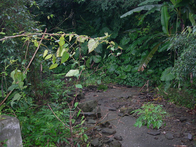
The first climb was a questionable road choice, and I knew as soon as I turned onto the road that it wasn't right. But in looking at the elevation profile, it seemed that this one was the higher of the 2 so I wanted to do this before trying the hard one. I immediately knew I was on a farming road and that car traffic here would be minimal to none. About halfway up I saw a car pulled off to the side and some guy was working on an embankment. Not sure what that's for as it's clear very, very few people come up here very often. I kept going even though I knew this road wasn't right. Eventually I was proved correct as the road simply became impassable:
Let me step back a bit and say how great these rides have been for me thus far. Every time we've come here in the past, I've always had this sense of wonder about what's "out there". I would often would look up at the hills and see temples or small shacks and think to myself how neat it would be to get up there and see them, just see what the hell is going on up there. Well finally, I can do that. I can get on my bike and pretty much just point and go. With the awesome Google maps feature of user-loaded pics, you can see just about any lookout in the world now. Combined with the satellite view you can check out an area and see if any roads are actually there, and if people have gone and uploaded pics for the area. Sprinkle in the GPS and you have both the adventure of an explorer and the security of the white-bred honky that I really am. It's totally a win-win!
Forgot to mention yesterday that my ears popped as I was climbing. It happened again today, twice. This is a cool phenomenon.
The way back down was really sketchy. It turns out that the roads which aren't traveled very often don't actually need to have wet cement dust sprinkled on the road. A thin layer of algae (or moss?) covers the road and as I was climbing up, my tires would actually spin out on the pedal stroke. Coming down this made things interesting, and for the second day in a row my hands hurt from braking so much. It's not that you can't stop on these roads. The more scary part is that this was "almost" a one-lane road (call it 5/6 of a lane) and if a car were coming up, no way you'd be able to stop in time.
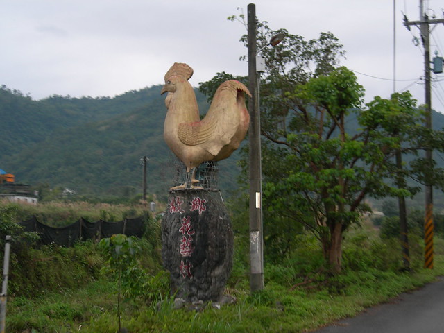
The official climb started with the rooster:
This time I knew I was on the right path, as some of the clues he had given me started to become evident. There was a road to the left to avoid, which went to a small temple. Then another road to the right which went to the bigger temple. There was a sign for it which I can't read but which was brightly colored and seemed to strike a bell as a temple sign. Plus, this road was much more traveled and there were really no turns to speak of. Google maps is great, but out here things can be a little inaccurate. The road went way past where Google maps said it was going to go and ended up being much more elevation that the first climb.
I have to give this guy credit, the climb was solid. He said the end got very steep and as I got close to the top the road turned and I saw the road pitch up pretty steeply. I never needed to stand, so it wasn't as bad as the worst NJ climbs, but it was a solid climb. Apparently, there was supposed to be a journal to sign when I got to the top but I wasn't sure if I'd find it or not. Well, it turns out that being blind might not be enough of an excuse to not find it:
I signed the book, took a few pics (see the link at the top), then turned around and went back down. As I got to the bottom I saw I had been out for 1:46, and had told Nat I would be 1.5 hours. I knew she wouldn't be too-too concerned. But I high-tailed it back to town because I was out much longer than I expected. I got home and hammered a late breakfast, then a bar of Dove chocolate, then hopped online to do some work. One of Nat's cousins came over and we had lunch. This one was beans, gizzard, and roast duck:

Chris asked about the organs and if animals have muscles here. There are no cows, so throw that one out. The primary "big" animal would be a pig, and the whole damn thing gets eaten. The meat sauce that was on top of the rice is made of pork, and pork bits are often used to flavor other kinds of rice or vegetables. In general, the people here don't take a pig, cut out the juiciest parts, and throw away the rest. The prime part is taken and spread as thin as possible to make the most of the animal. When you have 10 acres of land, you grow 9.5 acres of vegetables, and maybe use a half acre to grow grain for the pig. You also feed it slop leftovers. In the US, we would take the 10 acres of land, put 500 pigs on it, then plant 10,000 acres of grain in Kansas to feed it.
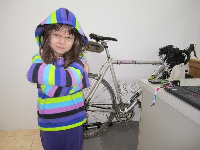
After lunch, I tried to teach Julia how to act gangster:
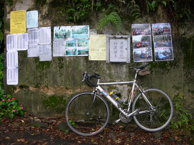
We'll need to work on that. We took a ride to the mall in Ilan (20 minutes north) to buy some stuff for Julia and burn some time away from the house. We went with Nat's dad while her mom stayed back at the house to relax a bit. We got her a puzzle and some toys then went to get some coffee up in the hotel on the roof of the mall. Later we went food shopping in the basement and found some cheese, cream cheese, and finally beer:
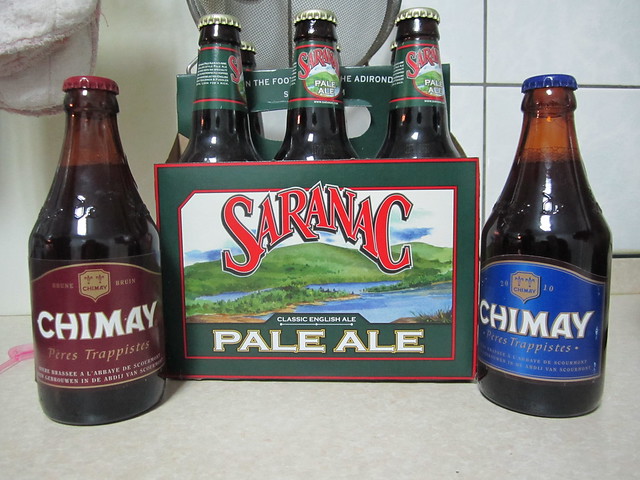
While Saranac isn't my favorite, it works. I think this cost me $10 for a 6 pack, which isn't terrible considering where we are.
Terren commented that he wishes I traveled more often so I would produce more stories like this. After careful consideration, I'm down with this idea. I just need to find someone to bankroll my excursions. I'm not sure how well this will play out after 44 days, so it might get old. I'll have to keep trying to do interesting things. Thankfully there are a) a million interesting places to ride and b) Nat has like 50+ cousins, many of them like Darin. Maybe I'll go have some beers with her dentist-supplier cousin. 98% chance the sake gets busted out if I do that.
Jim mentioned getting lost and if I can read any of these signs. No, I can't. Well, I can read the smallest bit of Chinese, but it would be mostly numbers and the word good or big. So if everything were named "big 3 road" or "good man road" I'd be fine. But they're not, so I rely on the county roads being marked (2, 7, 9, etc), and the GPS. The GPS set me right the first day, as I missed a turn near the apartment. On the hill climb days there's really nowhere to get lost. The roads that go up usually have only 2 options: up and down. Unless something suddenly propels you sideways, you generally only need to go out or back. I've gotten to know the town a little bit, but it's still confusing since every intersection looks the same.
So on to Tuesday...
Getting coffee this morning was harder, as the usual Dude Man was replaced with another wide-eyed sub-Dude Man who simply could not understand anything I said. I know my Chinese isn't great but it's pretty hard to screw up 1, 2, and 3. I knew I was in for a tough draw when I held up 3 fingers and he gave me 1 creamer. I don't think sub-Dude man was that dumb, he was just floored by a white man who was speaking his language. In the end, he just gave me 7 creamers and sugars, I guess to cover his bases. Not sure what 3 fingers means here. I held them sideways which maybe means, "I'm going to stab you if you don't give me an indeterminate number of creamers"?
My adventure on the bike for today was, of course, the "toughest climb in the county" or town, that I had heard about yesterday. After discussing with the FIL I decided to give it a go and loaded the GPS up last night. This wasn't one of the county roads, so winging it wasn't going to work. There seemed to be 2 climbs and I loaded them both on the GPS and decided to do them both just to cover my bases.
The first climb was a questionable road choice, and I knew as soon as I turned onto the road that it wasn't right. But in looking at the elevation profile, it seemed that this one was the higher of the 2 so I wanted to do this before trying the hard one. I immediately knew I was on a farming road and that car traffic here would be minimal to none. About halfway up I saw a car pulled off to the side and some guy was working on an embankment. Not sure what that's for as it's clear very, very few people come up here very often. I kept going even though I knew this road wasn't right. Eventually I was proved correct as the road simply became impassable:
Let me step back a bit and say how great these rides have been for me thus far. Every time we've come here in the past, I've always had this sense of wonder about what's "out there". I would often would look up at the hills and see temples or small shacks and think to myself how neat it would be to get up there and see them, just see what the hell is going on up there. Well finally, I can do that. I can get on my bike and pretty much just point and go. With the awesome Google maps feature of user-loaded pics, you can see just about any lookout in the world now. Combined with the satellite view you can check out an area and see if any roads are actually there, and if people have gone and uploaded pics for the area. Sprinkle in the GPS and you have both the adventure of an explorer and the security of the white-bred honky that I really am. It's totally a win-win!
Forgot to mention yesterday that my ears popped as I was climbing. It happened again today, twice. This is a cool phenomenon.
The way back down was really sketchy. It turns out that the roads which aren't traveled very often don't actually need to have wet cement dust sprinkled on the road. A thin layer of algae (or moss?) covers the road and as I was climbing up, my tires would actually spin out on the pedal stroke. Coming down this made things interesting, and for the second day in a row my hands hurt from braking so much. It's not that you can't stop on these roads. The more scary part is that this was "almost" a one-lane road (call it 5/6 of a lane) and if a car were coming up, no way you'd be able to stop in time.
The official climb started with the rooster:
This time I knew I was on the right path, as some of the clues he had given me started to become evident. There was a road to the left to avoid, which went to a small temple. Then another road to the right which went to the bigger temple. There was a sign for it which I can't read but which was brightly colored and seemed to strike a bell as a temple sign. Plus, this road was much more traveled and there were really no turns to speak of. Google maps is great, but out here things can be a little inaccurate. The road went way past where Google maps said it was going to go and ended up being much more elevation that the first climb.
I have to give this guy credit, the climb was solid. He said the end got very steep and as I got close to the top the road turned and I saw the road pitch up pretty steeply. I never needed to stand, so it wasn't as bad as the worst NJ climbs, but it was a solid climb. Apparently, there was supposed to be a journal to sign when I got to the top but I wasn't sure if I'd find it or not. Well, it turns out that being blind might not be enough of an excuse to not find it:
I signed the book, took a few pics (see the link at the top), then turned around and went back down. As I got to the bottom I saw I had been out for 1:46, and had told Nat I would be 1.5 hours. I knew she wouldn't be too-too concerned. But I high-tailed it back to town because I was out much longer than I expected. I got home and hammered a late breakfast, then a bar of Dove chocolate, then hopped online to do some work. One of Nat's cousins came over and we had lunch. This one was beans, gizzard, and roast duck:
Chris asked about the organs and if animals have muscles here. There are no cows, so throw that one out. The primary "big" animal would be a pig, and the whole damn thing gets eaten. The meat sauce that was on top of the rice is made of pork, and pork bits are often used to flavor other kinds of rice or vegetables. In general, the people here don't take a pig, cut out the juiciest parts, and throw away the rest. The prime part is taken and spread as thin as possible to make the most of the animal. When you have 10 acres of land, you grow 9.5 acres of vegetables, and maybe use a half acre to grow grain for the pig. You also feed it slop leftovers. In the US, we would take the 10 acres of land, put 500 pigs on it, then plant 10,000 acres of grain in Kansas to feed it.
After lunch, I tried to teach Julia how to act gangster:
We'll need to work on that. We took a ride to the mall in Ilan (20 minutes north) to buy some stuff for Julia and burn some time away from the house. We went with Nat's dad while her mom stayed back at the house to relax a bit. We got her a puzzle and some toys then went to get some coffee up in the hotel on the roof of the mall. Later we went food shopping in the basement and found some cheese, cream cheese, and finally beer:
While Saranac isn't my favorite, it works. I think this cost me $10 for a 6 pack, which isn't terrible considering where we are.
Labels: taiwan

0 Comments:
Post a Comment
<< Home